Recommended Tools:
- Typhoon Reporting – Japan Meteorology (jma.go.jp)
- Surf Forecasting Apps
- Surfline
- Line + Namiaru App (Japanese forecasting with cams)
- Windy App (for wind)
High Level – Tracking Typhoon Action
Use the JMA website to track when typhoons are developing and what their direction is forecasted. You can see typhoons potentially forming earlier on some other weather apps, but I wouldn’t consider it officially a typhoon that’s going to generate swell until you see it on the JMA site. Once it’s on the JMA site, you can pretty much count on it fully developing and plan your targeted surf trip accordingly.
Getting More Specific – Swell Direction & Size
Surfline or Similar Surf App
Most surf apps like Surfline will give you a fairly good idea about the swell size and direction coming off of a typhoon. It usually takes 2 to 4 days for the swell from the typhoon to reach the shore so you can make some rough estimates based on its location assuming that its swell will be pushed out from its center toward the coast of Japan.
I found that the specific locations and swells through surfline were accurate for some locations but quite far off for others. What was most helpful was looking at the charts which showed a color coating for wave height overtime and this would give me an idea of where the swell was headed and how strong it was.
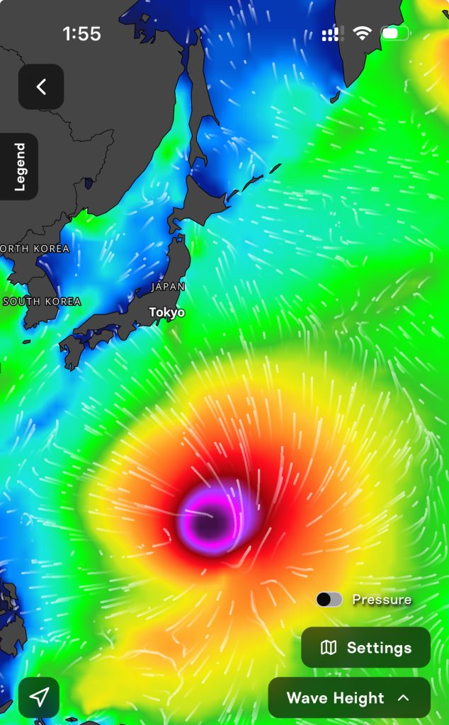
Being able to see the different swells in the water is also critical. The apps that only provide the primary swell in the water instead of giving the secondary and tertiary often weren’t picking up the swell from the typhoon and were just showing a small or otherwise irrelevant swell that was in the water.
Japanese Forecast & Cam Tool
If you get the messaging app Line, then you can sign up for the Japanese surf forecasting tool Namiaru, which has more accurate forecasts than other apps, and has cams for various brakes along the coast. There’s a little bit of a learning curve to get the Line app, add Namimaru, and then also translate the locations, but it’s worth it. The cams will help you match your forecasting to actual conditions and save you a lot of driving time and potentially a lot of disappointment.
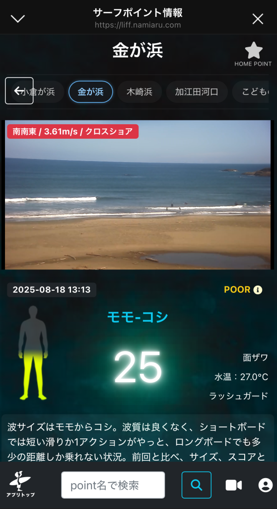
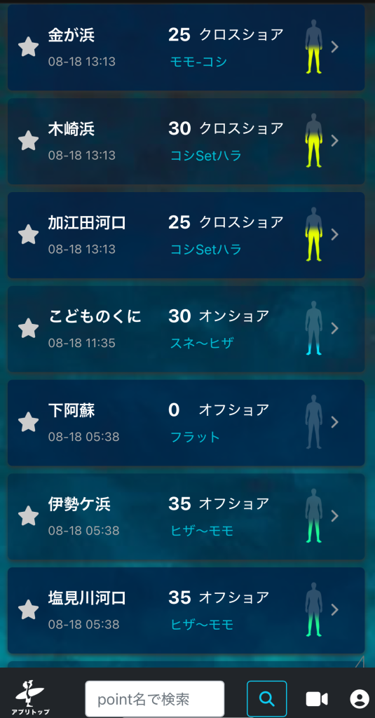
I was able to navigate the names of surf breaks within Namimaru by taking screenshots of the app and feeding it into a tool like ChatGPT or Gemini and ask for translations. You can also find a map-based report in the tool, which will allow you to click on locations along the coast. Not all locations have cams, but there are enough within various regions that you can check how much swell is coming in and what the wind conditions are like.
See: namiaru.com
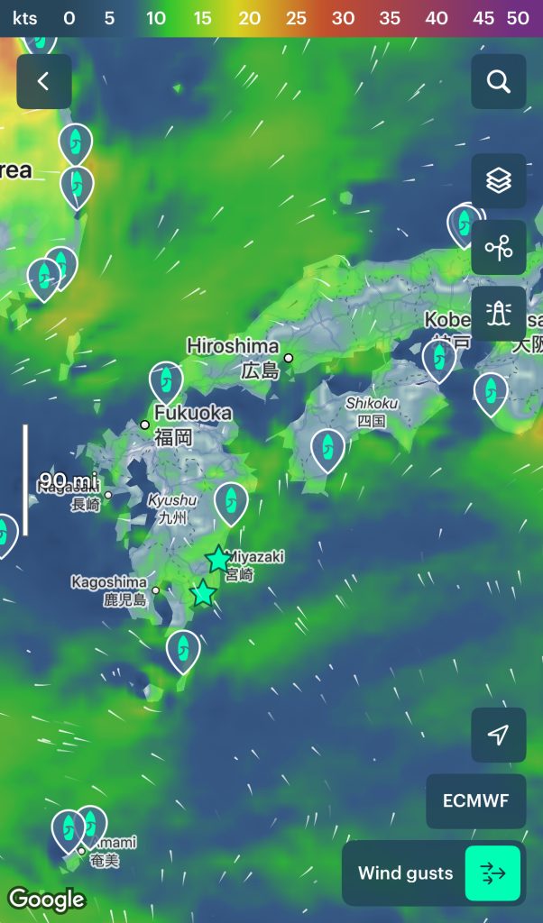
Final Adjustments – Wind
I use the windy app for accurate wind conditions and forecasts. You can play with the models available to see which one matches up best with Japan. I used the weather map to view regional weather patterns with the ECMWF model. This was accurate enough on a directional basis so I could see where it would be onshore, sideshore, or offshore, and where winds were stronger and weaker.
Final Tips
If you can make some friends once on the ground, they’ll be able to give you some tips and help you forecast. Staying at a surf hostel or talking to some people on the beach is an easy way to meet friendly locals. My experience has been that they are happy to help foreign surfers.